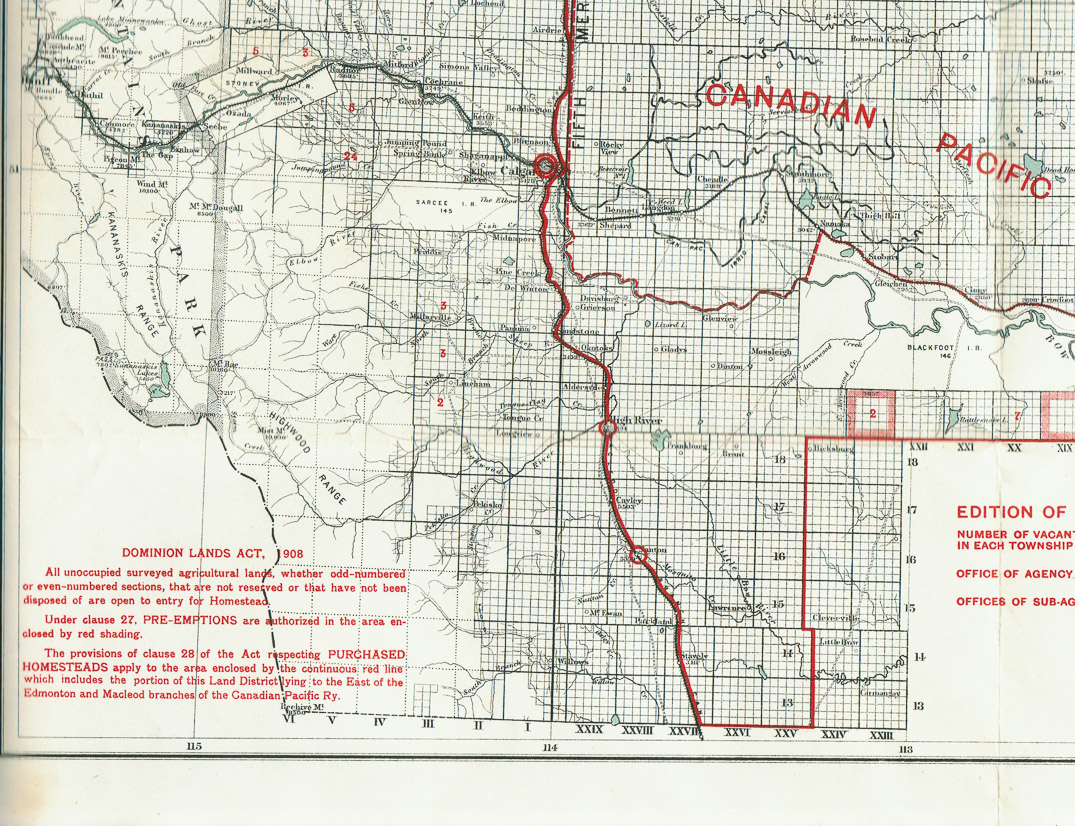
Maps showing homestead locations
The 1909 and 1922 maps show the number of vacant quarter sections when each map was published. Assume 1909 map is the one used by FAC to select the homestead. The 1918 map shows FAC's and AA's 1/2 sections.
Web Photo Gallery created by Wayne Coates. (click on images for full screen view, caption below each)